Unreal Engine シナリオ シミュレーション
Epic Games® の Unreal Engine® を使用して、事前生成およびカスタマイズされた 3 次元シーンで UAV をシミュレーションし、シミュレーションされた忠実度の高いセンサー読み取り値を生成します (Simulink® 3D Animation™ が必要)。この環境は Simulink で使用可能であり、Windows® および Linux® でのみ実行できます。詳細については、無人航空機用の Unreal Engine シミュレーションを参照してください。
また、UAV Toolbox は、シナリオを迅速に作成し、忠実度の低いセンサー データを生成できる直方体環境も提供します。詳細については、直方体シナリオ シミュレーションを参照してください。
オブジェクト
sim3d.Editor | Unreal Engine プロジェクトへのインターフェイス |
sim3d.maps.Map | Access additional scenes from the server (R2022b 以降) |
sim3d.environment.GeospatialConfiguration | Create 3D environment in Unreal Engine (R2024b 以降) |
関数
copyExampleSim3dProject | Copy support package files and plugins to specified folders (R2022b 以降) |
ブロック
| Simulation 3D UAV Vehicle | Place UAV vehicle in 3D visualization |
| Simulation 3D Custom UAV Pack | Translation and rotation input for custom UAV (R2026a 以降) |
| Simulation 3D Scene Configuration | Scene configuration for 3D simulation environment |
| Simulation 3D Camera | Camera sensor model with lens in 3D simulation environment |
| Simulation 3D Fisheye Camera | Fisheye camera sensor model in 3D simulation environment |
| Simulation 3D Lidar | Lidar sensor model in 3D simulation environment |
| Simulation 3D Ultrasonic Sensor | Ultrasonic sensor model in 3D simulation environment (R2023a 以降) |
| Video Send | Send video stream to remote hardware (R2021b 以降) |
シーン
| Suburban scene | Suburban Unreal Engine environment |
| US City Block | US city block Unreal Engine environment |
| Blank Scene | Blank scene |
| Empty Scene | Empty world |
トピック
シミュレーションの基本
- 無人航空機用の Unreal Engine シミュレーション
Simulink で無人航空機アルゴリズムを使用し、Epic Games の Unreal Engine を使用してバーチャル環境でパフォーマンスを可視化する方法を学習する。 - Unreal Engine シミュレーション環境の要件と制限
Unreal Engine 環境でシミュレーションするときに留意する必要があるソフトウェア要件、最小ハードウェア要件、および制限。 - UAV 用の Unreal Engine シミュレーションの仕組み
Simulink と Unreal Engine のコシミュレーション フレームワークおよびシミュレーションへのブロック実行順序の影響について学習する。 - 3D Scenes for Simulation in Unreal Engine Environment
Install 3D scenes for simulation in Unreal Engine environment. - Coordinate Systems for Unreal Engine Simulation in UAV Toolbox
World and vehicle coordinate systems used when simulating in the Unreal Engine environment. - Interact with 3D Simulation Environment
Interact with the 3D simulation environment and actors using the Simulation 3D Viewer interface. - Navigate in Unreal Engine Environment
Control the view of the 3D environment in the Simulation 3D Viewer using keyboard shortcuts and pointer controls. - Visualize with Cesium
Stream 3D map and terrain data of a location.
センサーを使用したシミュレーション
- Unreal Engine シミュレーション用のセンサーの選択
Unreal Engine での 3D シミュレーション中に使用するカメラ、または LiDAR センサーを決定する。 - Stream Camera, Depth and Semantic Segmentation Data from Unreal Engine to NVIDIA Jetson
Stream simulated camera, depth, and semantic segmentation label data from an Unreal Engine scene to NVIDIA® Jetson™ hardware using the Video Send block in Simulink.
シーンのカスタマイズ
- UAV 用の Unreal Engine シーンのカスタマイズ
UAV フライト アプリケーション用に Unreal Engine シーンをカスタマイズする。
- Apply Semantic Segmentation Labels to Custom Scenes
Apply labels to objects in a scene so that you can obtain semantic segmentation data from a camera sensor. - Prepare Custom UAV Vehicle Mesh for Unreal Engine Scenario Simulation
Configure custom UAV vehicle mesh for Unreal Engine scenario simulation.
セマンティック セグメンテーション
- Depth and Semantic Segmentation Visualization Using Unreal Engine Simulation
This example shows how to visualize depth and semantic segmentation data captured from a camera sensor in a simulation environment. - Map and Classify Urban Environment Using UAV Camera and Deep Learning
Use a UAV with a camera to survey and develop an orthomosaic of an urban environment.
注目の例

UAV の荷物配送
市街地環境で小型マルチコプターの離陸、飛行、および着陸をシミュレーションする。

Unreal Engine を使用した未踏環境における UAV の安全な着陸のシミュレーション
未踏環境における UAV の安全な着陸操作をシミュレーションする。

Unreal Engine 環境でのシンプルなフライト シナリオとセンサーのシミュレーション
Epic Games の Unreal Engine を使用するシミュレーション環境で、センサーを可視化する。
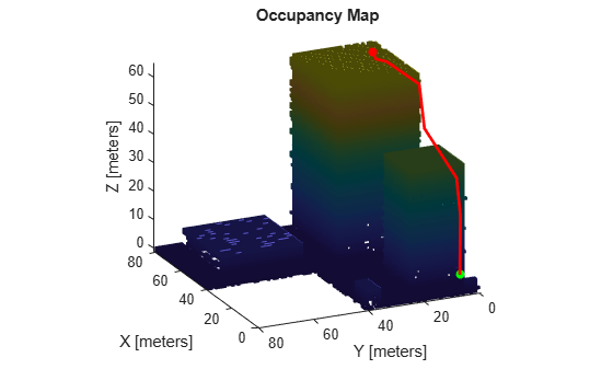
Map Environment for Motion Planning Using UAV Lidar
Use a UAV with lidar sensor to create a 3D occupancy map for motion planning.

Stereo Visual SLAM for UAV Navigation in 3D Simulation
Generate a map for a city block scene in an Unreal Engine environment using stereo visual simultaneous localization and mapping.