geotickformat
地理的目盛りラベルの形式の設定またはクエリ
説明
目盛りの形式の設定
例
ブラジルの 3 都市の位置および名前を指定します。
lat = [-23.55 -22.91 -15.79];
lon = [-46.63 -43.2 -47.8828];
n = [" Sao Paulo"," Rio de Janeiro"," Brasilia"];
bluegreen ベースマップに、塗りつぶされたマーカーを使用して位置および名前を表示します。
geoscatter(lat,lon,"filled")
text(lat,lon,n)
geobasemap bluegreen
geolimits([-24.8 -14.5],[-54.6 -37.1])
目盛りラベルの形式を 10 進数の度に変更します。-dd オプションは、マイナス符号 (–) を使用して南と西を表しています。
geotickformat -dd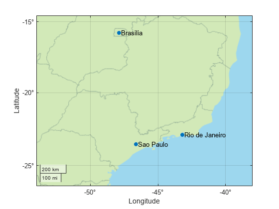
入力引数
出力引数
ヒント
関数
geotickformatは、座標軸のTickLabelFormatプロパティに保存されている形式をクエリします。地理座標軸の場合、座標軸に関連付けられた
GeographicRulerオブジェクトのTickLabelFormatプロパティを設定して、軸ごとに形式をオーバーライドすると、関数geotickformatにより返される値は、軸の形式または表示されるマップとは一致しません。軸ごとにTickLabelFormatプロパティを設定することは推奨されません。
バージョン履歴
R2019a で導入
1 Alignment of boundaries and region labels are a presentation of the feature provided by the data vendors and do not imply endorsement by MathWorks®.