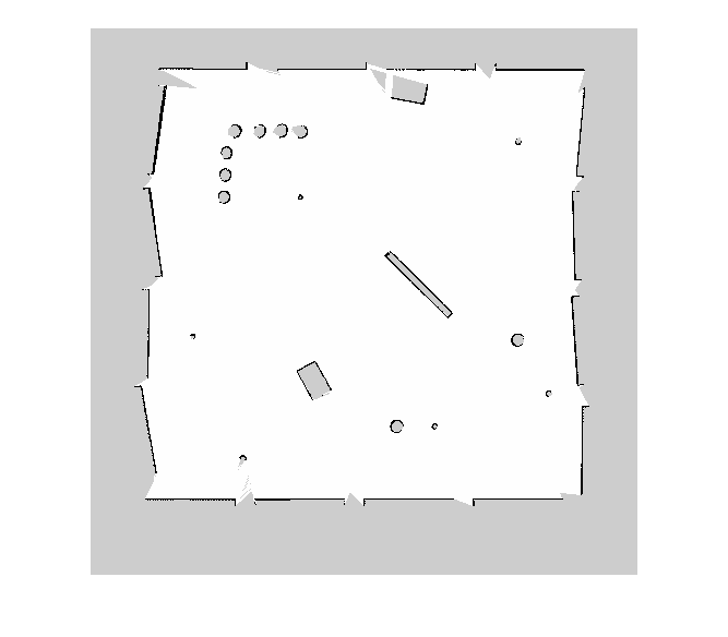
binaryOccupancyMap
バイナリ値の占有グリッドを作成
説明
binaryOccupancyMap は 2 次元の占有マップ オブジェクトを作成します。これを使用して、障害物を含むロボット ワークスペースを表して可視化できます。センサー データと位置推定の組み込みにより、障害物のおおよその位置の空間的表現が作成されます。
占有グリッドは、パス計画などのロボティクス アルゴリズムで使用します。また、衝突のないパスの検出、衝突回避、位置推定の計算などを行うためのアプリケーションの地図作成にも使用します。特定の用途に合わせて占有グリッドを修正できます。
占有グリッドの各セルには、そのセルの占有ステータスを表す値があります。占有位置は true (1) として表され、フリー位置は false (0) として表されます。
オブジェクトはワールド、ローカル、グリッドの 3 つの基準座標系を追跡します。ワールド座標系の原点は、ワールド座標系を基準としたマップの左下隅を定義する GridLocationInWorld によって定義されます。LocalOriginInWorld プロパティは、ワールド座標系を基準としたローカル座標系の原点の位置を指定します。インデックス (1,1) をもつ最初のグリッド位置は、グリッドの左上隅で開始します。
メモ
このオブジェクトは以前、robotics.BinaryOccupancyGrid という名前でした。
作成
構文
説明
map = binaryOccupancyMap は、幅と高さが 10 m の 2 次元バイナリ占有グリッドを作成します。既定のグリッド分解能は 1 メートルあたり 1 セルです。
map = binaryOccupancyMap(rows,cols, は、サイズ (resolution,"grid")rows,cols) の 2 次元バイナリ占有グリッドを作成します。
map = binaryOccupancyMap( は、行列 p)p の値からグリッドを作成します。グリッドのサイズは行列のサイズに一致し、各セル値は行列内の位置から解釈されます。p には、0 と 1 からなる任意の数値型または logical 型が含まれます。
map = binaryOccupancyMap( は、1 メートルあたりのセル数で指定される p,resolution)Resolution プロパティを使用して行列からマップを作成します。
map = binaryOccupancyMap( は、別の sourcemap)binaryOccupancyMap オブジェクトの値を使用してオブジェクトを作成します。
map = binaryOccupancyMap( は、別の sourcemap,resolution)binaryOccupancyMap オブジェクトの値を使用してオブジェクトを作成しますが、指定された分解能をもつように行列をリサンプリングします。
map = binaryOccupancyMap(___, は、1 つ以上の名前と値の引数を使用してプロパティを設定します。Name=Value)
入力引数
プロパティ
オブジェクト関数
copy | Create copy of binary occupancy map |
checkOccupancy | Check if locations are free or occupied |
getOccupancy | Get occupancy value of locations |
grid2local | グリッド インデックスをローカル座標に変換 |
grid2world | グリッド インデックスをワールド座標に変換 |
inflate | 各占有位置のインフレーション |
insertRay | Insert ray from laser scan observation |
local2grid | ローカル座標をグリッド インデックスに変換 |
local2world | ローカル座標をワールド座標に変換 |
move | Move map in world frame |
occupancyMatrix | 占有グリッドを行列に変換 |
raycast | Compute cell indices along a ray |
rayIntersection | Find intersection points of rays and occupied map cells |
setOccupancy | 位置の占有値を設定 |
show | Display binary occupancy map |
syncWith | Sync map with overlapping map |
world2grid | ワールド座標をグリッド インデックスに変換 |
world2local | ワールド座標をローカル座標に変換 |
![Figure contains an axes object. The axes object with title Binary Occupancy Grid, xlabel X [meters], ylabel Y [meters] contains an object of type image.](../../examples/nav_robotics/win64/CreateAndModifyBinaryOccupancyGridExample_01.png)
![Figure contains an axes object. The axes object with title Binary Occupancy Grid, xlabel X [meters], ylabel Y [meters] contains an object of type image.](../../examples/nav_robotics/win64/CreateAndModifyBinaryOccupancyGridExample_02.png)
![Figure contains an axes object. The axes object with title Binary Occupancy Grid, xlabel X [meters], ylabel Y [meters] contains an object of type image.](../../examples/nav_robotics/win64/CreateAndModifyBinaryOccupancyGridExample_03.png)
![Figure contains an axes object. The axes object with title Binary Occupancy Grid, xlabel X [meters], ylabel Y [meters] contains an object of type image.](../../examples/nav_robotics/win64/ImageToBinaryOccupancyGridExampleExample_01.png)


![Figure contains an axes object. The axes object with title Binary Occupancy Grid, xlabel X [meters], ylabel Y [meters] contains an object of type image.](../../examples/nav_robotics/win64/ConvertPGMImageToMapExample_03.png)