utmzoneui
Identify UTM zone by clicking map
Description
zone = utmzoneui
Examples
Open the Pick UTM Zone dialog box.
zone = utmzoneui
Identify a zone in Europe by clicking the map. The function highlights the zone on the map and displays the zone in the UTM Zone box.
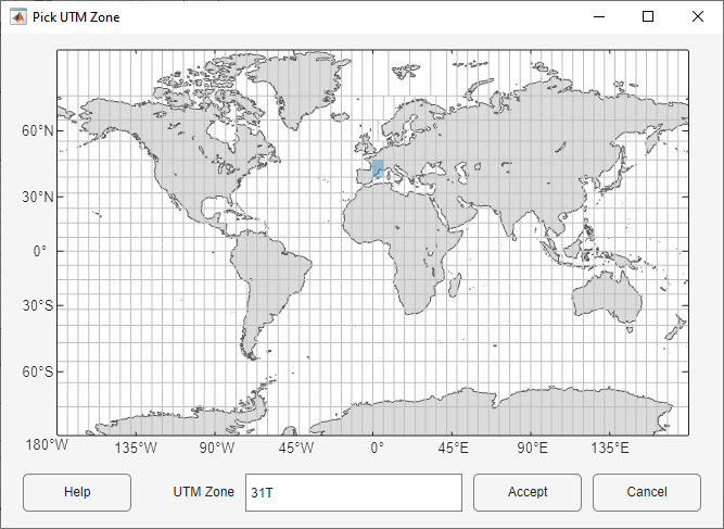
Return the UTM zone by clicking Accept.
zone =

'31T'Open the Pick UTM Zone dialog box.
zone = utmzoneui
View zone 19F on the map by typing 19F in the UTM
Zone box and pressing Enter.
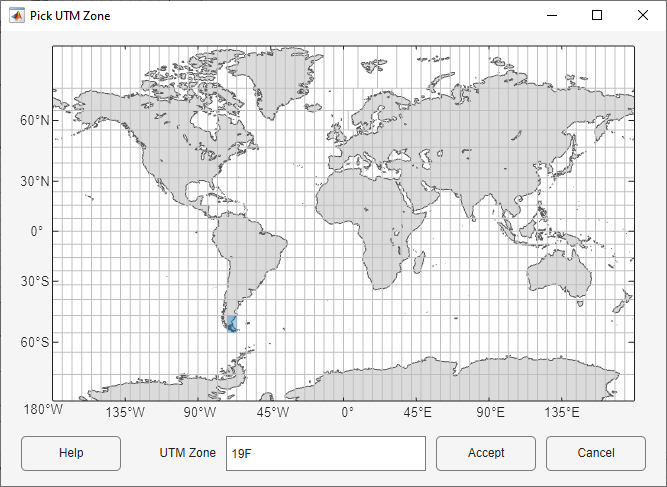
Return the UTM zone by clicking Accept.
zone =

    '19F'
Input Arguments
Output Arguments
Alternative Functionality
The utmzone function enables you to:
Identify UTM zones from latitude and longitude coordinates.
Find the latitude and longitude limits of UTM zones.