geocrop
Crop geographic raster
Description
[
crops the geographic raster B,RB] = geocrop(A,RA,latlim,lonlim)A, which uses the raster reference
RA, and returns the cropped raster B and raster
reference RB. The returned raster is cropped to geographic limits in
degrees close to those specified by latlim and
lonlim.
To clip vector data represented by a point, line, or polygon shape in geographic
coordinates, use the geoclip function
instead.
Examples
Crop a geographic raster and display the cropped raster on a map.
First, load elevation raster data and a geographic cells reference object for the Korean peninsula. Then, crop the raster to the limits specified by latlim and lonlim.
load korea5c
latlim = [34.25 38.72];
lonlim = [125.85 129.92];
[B,RB] = geocrop(korea5c,korea5cR,latlim,lonlim);
Display the cropped raster as a surface on a map. Apply a colormap appropriate for elevation data using the demcmap function.
worldmap(latlim,lonlim)
geoshow(B,RB,'DisplayType','surface')
demcmap(B)

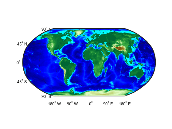
Shift the longitude limits of a raster with limits that span 360 degrees using the geocrop function. Then, display the shifted data as a surface on a map.
First, load elevation raster data for the world and a geographic cells reference object. Then, shift the longitude limits of the raster from [0, 360] to [-180, 180].
load topo60c
latlim = topo60cR.LatitudeLimits;
[B,RB] = geocrop(topo60c,topo60cR,latlim,[-180 180]);
Compare the rasters by querying their LongitudeLimits properties.
topo60cR.LongitudeLimits
ans = 1×2

     0   360
RB.LongitudeLimits
ans = 1×2

  -180   180
Display the shifted data as a surface on a map. Move the meridian labels to the bottom of the map using the mlabel function. Specify meridian labels to display using the MLabelLocation property. Then, apply a colormap appropriate for topographic data using the demcmap function. Note that the shifted longitude limits appear at the edges of the map.
worldmap(RB.LatitudeLimits,RB.LongitudeLimits)
geoshow(B,RB,'DisplayType','surface')
mlabel('south')
setm(gca,'MLabelLocation',-180:90:180)
demcmap(B)
Input Arguments
Output Arguments
Tips
To crop a raster in planar map coordinates, use the
mapcropfunction.To create a raster with limits that match
latlimandlonlim, resample the raster by using thegeoresamplefunction.
Version History
Introduced in R2020a